We firmly believe in Oskari!
Minna Huovinen from Sitowise Ltd is leading several open source projects, Oskari is only one of the tools they are using - GeoServer, QGIS, Leaflet and all the FOSS4G tools are part of their repertuar.
Minna was presenting their Oskari and FOSS4G projects last autumn (2019) during Oskari & OSGeo Finland tour in Turku and she said that they at Sitowise firmly believe in Oskari-platform and its strengths:
“Oskari is easy to take into use and it is very user friendly. We have over 10 projects where we develop Oskari in one way or another. We are also actively participating in Oskari PSC and the Joint Development Forum. If Oskari is the right tool for our clients project, we tend to use it”.
Creating GIS tools for clients with Oskari
Sitowise hosts and develops Oskari core services but also creates new Oskari bundles - tools that can be attached to the Oskari setup if needed. One of those bundles can be tested at the download and viewing service) provided by Väylä (Finnish Transport Infrastructure Agency). There Väylä has over 200 datasets from roads to sea-fare that users can view.
With a Oskari community built bundle called the Download Basket, the users can fetch geospatial datasets straight from the data providers services. The Download Basket was created as a joint development effort for Oskari with multiple organisations as clients for the tool a few years back.
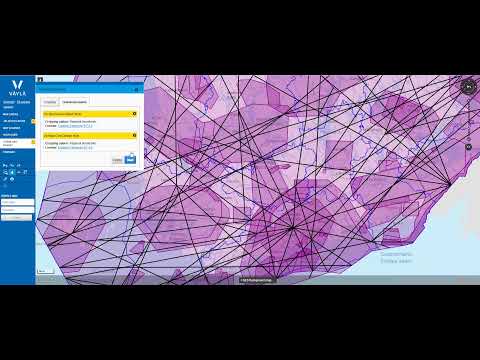
Väylä has over 200 datasets that you can view and download.
Embedded map is the key thing in Oskari
Minna thinks that the best thing with Oskari is its ability to publish embedded maps and they at Sitowise thrive to use it as much as possible.
A fairly widely used service was created by Sitowise for Väylä where Oskari's embedded map is quite handy: The Finnish private road registration system. There is a simple form for the private road managers to fill out and a map window that shows which private roads have already been marked and which are lacking the information. We must also state that there are quite a lot of private roads in Finland.
SeutuAtlas is also a good example of the embedded maps possibilities. The energy efficiency service developed for Helsinki Environmental Services shows e.g. the solar power hot spots in the city. For investors and contractors, the best part is the search abilities. From SeutuAltas you can check what is the current central heating in different types of buildings in a certain area. SeutuAtlas is also a good example of how you can use Oskari RPC and create your own look for the map service.
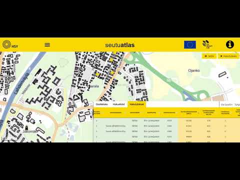
Seutuatlas providing information about energy efficiency in Helsinki region.
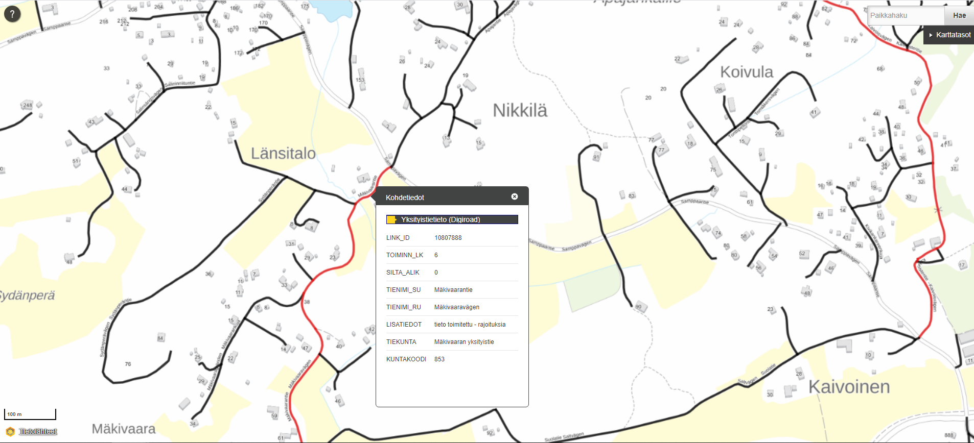
Private roads on a map (black ones have not been submitted to the system).
Oskari services hosted or developed by Sitowise
Other Oskari-based services developed by Sitowise in collaboration with their clients are:
- Palauteväylä a feedback service for road users. Oskari is used behind the scenes - in the management side and handling feedback information. The administrators of the service process the feedback via a published map from Oskari instance connecting the feedback information to the map with RPC technology. It was developed for Väylä, Traffic Management Finland and Centre of Economic Development, Transport and the Environment.
- HSY open data portal is a regional environmental data service operating in Helsinki region with download possibility for datasets.
- Museum network map service is a portal created for the Finnish Heritage Agency, showcasing several datasets in the fields of archaeology and cultural history.
- Valkeakoski municipality map service
- Lounaistieto map service is part of a regional SDI operating in SW Finland.
- Liiteri map service is partly open for all but also offers restricted datasets for registered users. Liiteri is provided by the Finnish Environment Instute (SYKE).
- Oskari in Statistics Finland (beta)
- Harava is a map questionnaire system developed and hosted by Sitowise Ltd.